
The City of Regina continues to invest in active transportation infrastructure for all users. This work helps reduce traffic congestion, improve safety, lower greenhouse gas emissions, improve affordability and keep our streets accessible to people of all ages and abilities.
This goal is guided by the Transportation Master Plan, Vision Zero, the Energy and Sustainability Framework and the Accessibility Plan, which focus on building integrated, sustainable and active transportation networks to connect neighbourhoods, parks and other key destinations.
The City launched the Crosstown Bike Route project in 2021 to create an east–west cycling route connecting the Cathedral, Centre Square, Heritage, Gladmer Park, Al Ritchie and Boothill neighbourhoods with Downtown.
Some segments of the Crosstown Bike Route are already complete, while other areas are still in progress or in a planning phase.
Complete:
- Protected Bike Lane (2022): Along 13th Avenue from the Devonian Pathway at Forget Street to Lewvan Drive
- Multi-Use Pathway (2022): From the southeast corner of the 13th Avenue and Lewvan Drive intersection to the intersection of Edwards Street and 14th Avenue
- Advisory Bike Lane (2022): Along 14th Avenue from Edwards Street to Elphinstone Street
- Multi-Use Pathway (2023): Along College Avenue from Smith Street to Broad Street
Work in Progress:
- Along Lorne Street from Victoria Avenue to College Avenue (as a part of the Central Loop Trail)
- Along College Avenue from Broad Street to Winnipeg Street
- Along 17th Avenue from Winnipeg Street to Park Street
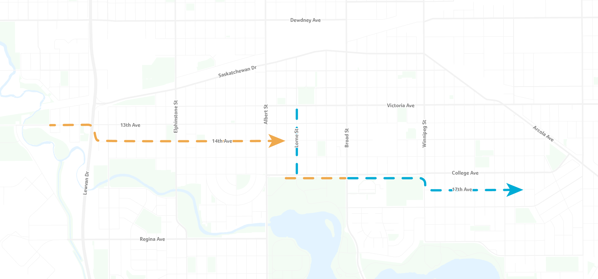
This route connects a series of neighbourhoods in Regina’s City Centre improving connectivity and transportation options. The orange lines show sections that are complete while the blue line shows parts of the route that are in progress.
The Central Loop Trail is a long-term visionary project to create a multi-use pathway that connects key City Centre districts.
The pathway will provide a safe active transportation connection between the Wascana Centre, Centre Square neighbourhood and Downtown via the Downtown Line, Warehouse District and REAL Campus via the Green Line and the Devonian Pathway via the Creek Line.
This loop is designed to connect with existing and planned walking and cycling amenities, improving access within the City Centre area.
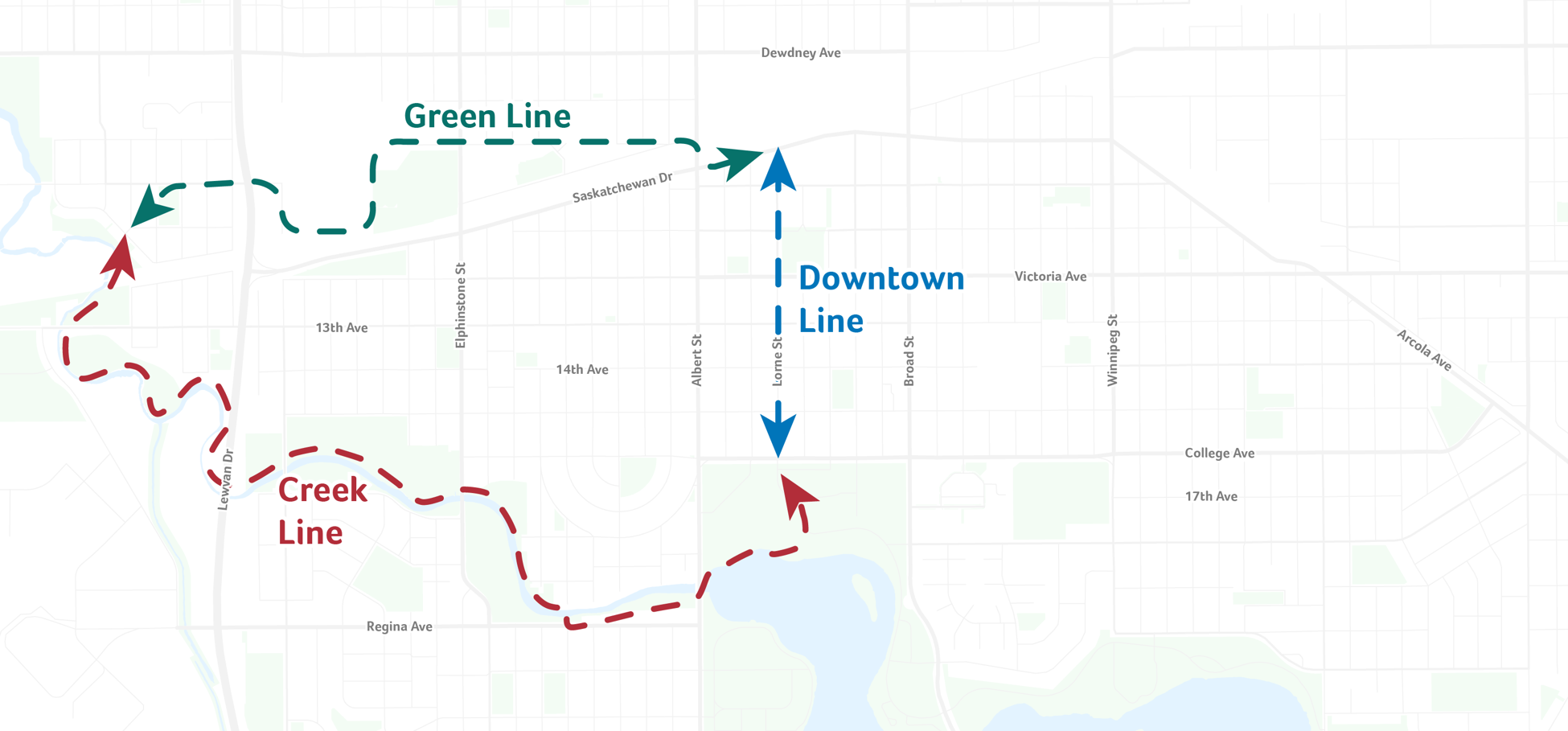
The concept for this trail is to have a multi-use network for walking or cycling to link key recreational, cultural, educational and commercial destinations with future developments across the City Center.