Wascana Pool
n be made through the University of Regina parking kiosk in the lot. Free parking is available in
lots 20 and 21 after 5 p.m. and on weekends. 360° Tour of Wascana
Pool Explore the Wascana Pool with our 360° tour available by
clicking here. The tour is also available on Google Maps. Accessible
for Everyone As of its opening, Wascana Pool is one of the most accessible and inclusive outdoor
aquatic facilities in the country with features such as: Accessible washrooms and changerooms
including lift and personal care table Changerooms and washrooms are individual, all gender spaces.
Zero depth entry options into all pools Signage includes braille, tactile markings and a tactile
map for those with visual impairment. Accessible side by side slides Aqua wheelchairs and aqua
walkers available Mechanical lifts for all pools Accessible playground and spray pad beside the
facility, free to park users of all ages and abilities Wascana Pool Aerial Facility Photos
Accessible Changeroom Front Entrance Gate Art by Larissa Kitchemonia Facility Photos Facility
Photos Playground Entrance Hot Tub 25m Leisure Pool Facility Photos Sinks in the Washroom and
Changeroom Area Facility Photos Playground Facility Photos Tactile Map Waterslides Facility Photos
Facility Photos Spray Pad Facility Photos Photos Facility Photos Three types of water wheelchairs
and one water walker Wascana Pool Aerial Shot Facility Photos Facility Photos Facility Photos Lane
Pool, Diving Boards, and Rock Climbing Wall Lazy River Local Anishnaabe-Saulteaux artist from The
Key First Nation, Larissa Kitchemonia, designed the gate that greets visitors of Wascana Pool. The
installation is a metal artwork inspired by the land. The first layer is a bed of buffalo skulls
that is a nod to the historical Cree term “Oskana-Ka-asateki: which loosely means, the place where
the bones are piled together. The second layer of the diorama is of Bison running up as a
representation of reconciliation and cultural revitalization. This signifies the resurgence of
shared cultures and shared space found within Regina. The flora depicted in the diorama consists of
interpretations of plants found around Wascana. ...
FROST Regina Returns for Olympic-Sized Fun in 2026! Enjoy Three FROSTY Weekends
to welcome everyone to the party.” Many fan-favourite activities are returning including
horse-drawn carriage rides, the Winter Hop Circuit brewery tour and
skating under the lights at Victoria Park. The Globe Theatre will also add a touch of theatrical
fun to downtown, while the Conexus Arts Centre hosts weekend brunch experiences in Wascana Centre.
"We are excited for FROST Regina 2026. We've added new partners and new activities so that as many
people as possible can enjoy this winter festival,” said Jennifer Johnson, Deputy City Manager of
Communications, Service Regina & Tourism. “Additionally, almost every location has an outdoor
and indoor component so that regardless of the weather, everyone can maximize their time having
fun." Free and ticketed activities will be available throughout Regina Downtown, REAL District,
Wascana Centre and the Warehouse District on February 6 to 8, 13 to 16 (including Family Day) and
20 to 22. Additional event details and a full schedule will be announced soon. Visit
FROSTRegina.com for the countdown and follow FROST Regina on Instagram on Facebook for sneak peeks
of all the FROST fun.
Concept Plan - The Towns
View the approved concept plan for The Towns.
Regina History & Facts
raph of the Legislative Building in 1925. Looking south from the lake past the gardens to the
building. A cannon is in the left foreground. Heritage Walking Tours Archives Learn the history behind street and park names in Regina
I Love Regina Day
bitors and Performers information page to learn more and complete the application(s). Information
for Exhibitors and Performers I Love Regina Run & Walk We are
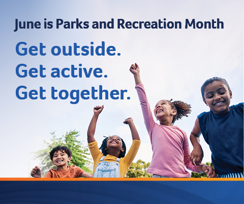
pleased to partner with Run Regina to feature the I Love Regina Run & Walk along with the day’s celebrations in Victoria Park! Let’s get everyone
moving and celebrate our great city. Movement and fitness are essential to our physical and mental
health, so get the whole family together to run, walk or wheel while
showing your love for Regina. Registration is now open! Register for the I Love Regina Run Show
your Civic Pride I Love Regina merchandise will be available for sale at the event near the
Information Tent. To purchase clothing or items in advance, visit the online store at
ILoveReginaGear.ca or visit City Hall to purchase in person! Find events and fun things to do
around Regina! Tourism Regina
Community Wellbeing & Inclusion Programming Participant Information with Photo Release Form
View the Community Wellbeing & Inclusion Programming Participant Information with Photo Release Form.
Roadway Standard Drawings
View the Standard Construction Specification for Roadway Standard Drawings.
From Smartphones to E-Bikes: Fire Prevention Week Focuses on Lithium-Ion Battery Safety
n Open House. Regina Fire & Protective Services invites residents to visit the Fire Station
open houses throughout the week. Open houses allow you to tour the
fire station, meet firefighters and learn more about lithium-ion battery safety and fire safety in
your home! Fire Station Open Houses: • Wednesday, October 8, 6:30 - 8:30 p.m. Fire Station #5, 2700
E Arens Road • Saturday, October 11, 1:30 - 3:30 p.m. Fire Station #6, 303 Rink Avenue “We all have
lithium-ion batteries in our homes, from lawn and power tools, to children’s toys, to the
electronics we carry with us everywhere, these batteries power most rechargeable things,” said Fire
Chief Layne Jackson. “Knowing how to safely buy, charge and dispose of these batteries is critical
to fire safety in your home.” To keep your family safe, Regina Fire & Protective Services and
the National Fire Protection Association reminds residents to: 1. Buy only safety certified
products. ...
Celebrate I Love Regina Day this Saturday
f performances from local talent. Headlining this year will be Regina’s own The Down Home Boys. The
day will kick-off with the I Love Regina Run and Walk at 8:30 a.m.,
inviting participants of all ages to run, walk or wheel their way
through 3K, 5K or 10K accessible routes. The race concludes in Victoria Park, where the rest of the
entertainment will take place. Visit Regina.ca/ILoveRegina to register for the I Love Regina Run or
to learn more about I Love Regina Day.
Photo Scavenger Hunt 2022
2022 Winter Photo Scavenger Hunt Tasks
Sportplex - Fieldhouse & Lawson Aquatic Centre
ipt.src = "https://app.cloudpano.com/public/shareScript.js"; script.defer = true;
script.dataset.short = "n6R5MZ4YPTno"; script.dataset.path = "tours"; script.width = "100%"; script.height = "500px"; const target =
document.getElementById("n6R5MZ4YPTno"); if (target) { target.appendChild(script); }}, 2000) 360°Tour North West Leisure Centre Leisure Guide Sandra Schmirler
Leisure Centre Drop-in Activities Sportplex Changes and Cancellations (June 2026) Court Booking
Instructions Lawson Pool General Weekly Use Schedule Summer 2026 Leisure Guide (Text-Only) Summer
2026 Free Programs Brochure How to Create a Wish List (Prepare for Registration Day) Automated
Waitlist Guide Swim Apparel Guidelines How to Become a Lifeguard or Swimming Instructor Swimming
Lesson Registration Chart Drop-in Activities
Rules of the Road
nd various pedestrian destinations. Touchless Accessible Pedestrian Signals Many signalized
intersections have a button you may push to activate the WALK/DON’TWALK pedestrian signal. If the button is pushed, the WALK signal could stay on longer to allow you the extra time to cross the
street. If the button is not pushed, more ‘green’ time could be given to motorists. This allows
more traffic to travel through the intersection and reduces congestion. If you are at a signalized
intersection with a pedestrian push button, you must use it or you will not get a WALK signal allowing you to cross. For some intersections that have heavy
pedestrian volume, pedestrian phase could be provided every phase during off peak hours.
Understanding Pedestrian Signals Pedestrian signals tell you when it is safe to cross: A "WALK" or “WALKING SYMBOL” means you may
begin crossing. A flashing "DON'T WALK" or flashing “HAND SYMBOL”
serves as a warning that it is to late to begin to cross the street. However, if you entered the
cross walk before the signal began to flash, you should have enough
time to cross the street. A solid "DON'T WALK" or solid ‘HAND SYMBOL”�
indicates that it is unsafe to cross the street. You should wait until the WALK signal appears again before crossing the street. Pedestrian Push Buttons at
Signalized Intersections Signs Construction and detour signs are posted to warn you that road work
is being done in the area. You must obey the speed limits posted on the signs, as these limits
ensure the safety of workers and other motorists. Even if you cannot see any activity in a
construction zone, you should reduce your speed to the posted limit because other hazards – like
gravel chips and uneven pavement – may be present and cause damage to your vehicle if you are
travelling at high speeds. You should also leave plenty of space between road crews/equipment and
your vehicle when going through a construction zone and obey all directions by flag people.
Construction & Detour Signs Children at Play signs are not part of the Canadian Manual of
Uniform Traffic Control Devices, and therefore, are not used by the City of Regina. If you can buy
it, its not legal. These signs are not recommended for municipalities because: studies show these
signs have no effect on motorists to control speeding motorists need to watch for children playing
near every residential street, and not just the street where the sign is located these types of
signs suggest to children that it’s okay to play on the street, which is not the case The City of
Regina only posts warning signs when motorists need to be advised of unusual or unexpected
conditions. Children at Play Signs Learn more about no parking and no stopping zones. No Parking:
Vehicles can only stop briefly to drop someone off or pick someone up in this zone. You may not
park your vehicle and wait for someone. No Stopping: Vehicles must not stop here for any reason,
including dropping off or picking up passengers. You may only stop here to obey traffic signals or
signs, for emergency personnel, traffic flow, or due to an emergency. You must remain behind the
wheel of your vehicle as it is illegal to stay parked for any length of time. Additionally, your
vehicle must be moved immediately should traffic conditions warrant or if you are directed to do so
by parking enforcement personnel. As well, you cannot park your vehicle: within 10m of an
intersection with a painted crosswalk on the continuous side between the painted crosswalks at a “T”�
intersection within 2m of a fire hydrant in an alley unless the vehicle is being actively loaded
or unloaded and is not blocking traffic within 3m of an alley that intersects with a street within
2m of any private driveway more than 0.6m away from the curb No Stopping or No Parking Signs Stop
signs, 2-way stops, 3-way stops, and 4-way stops assign the right-of-way at that intersection and
help to control traffic at busy intersections. Some people feel that installing a stop sign or
all-way stop on their street will reduce speeding, however, this is not usually the case. Studies
have shown that stop signs are ineffective at controlling speed along a street. Most motorists will
speed up after they stop, and in many cases, actually drive faster to make up for the delay. Stop
Signs: A stop sign may create more hazards if installed in the wrong place. As stated above, it may
actually increase speeding. As well, motorists may ignore the stop sign if the intersection is
always empty, thus becoming a danger to pedestrians and other motorists. All-Way Stops: The City of
Regina uses a warrant standard developed by the Transportation Association of Canada to determine
if an intersection should receive an all-way stop (e.g., 2-way, 3-way, 4-way). This standard
considers the traffic volumes on the streets, the number of right-angle collisions, and speed
limits. All-way stops are only installed at locations where two major streets intersect and traffic
volumes on each street are about equal. If traffic volumes were not equal, the all-way stop would
create unnecessary delays to the major flow of traffic. If you feel an intersection should be
evaluated for an all-way stop warrant, submit a Service Request with the relevant information. Stop
Signs & All-way Stops Traffic The City of Regina constantly studies traffic flow, volumes and
speeds to ensure the most efficient and safe movement of motorists and pedestrians in Regina. Speed
limits are determined based on provincial legislation and/or established North American traffic
engineering procedures. If a situation warrants it, the City of Regina can monitor and investigate
traffic volumes and speeds to determine if changes should be made. Monitoring Traffic Flow &
Speed Limits The Traffic Bylaw identifies the speed limits for all roads in our community. These
speed limits are determined based on dry pavement conditions. Within city limits, the default speed
limit on all roads is 50 km/h unless otherwise posted. School zones are maximum 30 km/h as
indicated by signage. Playground zones are maximum 30 km/hr or as indicated by signage. Refer to
the Traffic Bylaw for information. Speed is enforced by Regina Police Service. Alleys are maximum
30 km/h. Construction zones with temporary speed reductions for safety must also be observed. All
motorists are expected to reduce their speed in adverse weather conditions. The authority to change
the legal speed limit on Regina roads rests with City Council, however, Administration makes
recommendations on appropriate speed limits. Determining Speed Limits Calculating a recommended
speed limit for a particular street is influenced by: roadway geometry adjacent land use traffic
volumes accident history established North American traffic engineering procedures In North
America, the procedure to establish an appropriate speed limit is based on the “85th percentile
speed” principle. This means the speed limit will be set as near as practical to the speed at which
85% of vehicles are travelling along that road. Experience across North America has shown that 85%
of drivers will operate their vehicle at a speed that is reasonable and prudent. Requests to Lower
or Increase Speed Limits You may think lowering the posted speed limit will discourage speeding
along your street. However, this is normally not the case. Research has shown that drivers will
drive at a speed which they are comfortable with, regardless of the posted speed limit. In fact,
unrealistically low speed limits can invite violation by responsible drivers and create new
problems in our neighbourhoods: Artificially low speed limits increase the difference between the
fastest and slowest drivers which has been proven to reduce safety. Artificially low speed limits
lead to shortcutting on nearby streets. Increasing speed limits may also not be feasible depending
on roadway geometry, adjacent land use, or previous accident history for that street. Submit a
Service Request if you wish to request a review of the speed limit on a certain street. Speed
Limits Each year, the City of Regina collects traffic data at hundreds of locations. This
information is used to determine the need for traffic signals, all-way stops, pedestrian protection
and traffic calming. The Annual Traffic Flow Map shows the average number of motorists travelling
on major Regina roads in one 24-hour period. Traffic flow volumes listed are the total of vehicles
travelling in both directions. ...