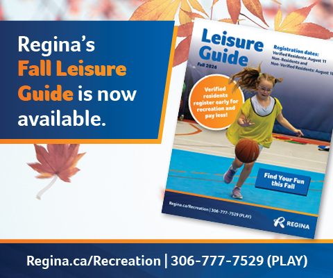
City of Regina Releases Winter/Spring Leisure Guide
the North West Leisure Centre (NWLC), Sandra Schmirler Leisure Centre (SSLC) or Sportplex. For more
information or to view the Leisure Guide online, visit
Regina.ca/LeisureGuide.
Regina at a Glance
View the 2020 snapshot of Regina.
Agendas and Meeting Documents
p.m. Agenda Packet Delegation List Minutes Video Register to Speak default Audit & Finance
Committee - July 30, 2026 4:00 PM - CANCELLED Please visit the RPS
Website to view any upcoming meeting agendas. default Board of Police Commissioners - May 26, 2026
9:00 AM Agenda Packet Delegation List Minutes Video Register to Speak default Regina Planning
Commission – Tuesday, July 21, 2026 at 4:00 p.m. Agenda default Regina Appeals Board - February 12,
2026 5:30 PM Agenda default Development Appeals Board - August 11, 2026 5:30 PM Agenda default
Board of Revision - April 10, 2026 1:00 PM As this is an interim solution while we manage
intermittent issues with our current Meeting Portal, only current meeting agendas will be posted on
this page. If you are looking for historical meeting documents, that are temporarily not available
on the Meeting Portal, please submit a request with the details by emailing clerks@regina.ca.
Public Notice Website (PL202200276)
Public Notice - 2977 Trombley Street
Firepit and Barbeque Safety
t a service request online at Regina.ca. In an emergency, call 9-1-1. For a complete list of
firepit regulations and outdoor fire safety information, visit
Regina.ca/Firepit.
Zoning Bylaw Handout-Building Types
Learn more about the changes to Building Types in the Zoning Bylaw 2019-19
Winnipeg Street Overpass Project
ping Investment $28.8 million This project was funded in part by the Government of Canada; for more
information on federal infrastructure funding, visit
infrastructure.gc.ca. Winnipeg Street Overpass On and Off Ramps Looking West Winnipeg Street
Overpass Winnipeg Street Overpass Winnipeg Street Overpass Driving steel piles Winnipeg Street
Overpass Arial View - Photo Credit to Michael Lam Winnipeg overpass MSE wall Winnipeg Street
Overpass Winnipeg Street Overpass Winnipeg Street Overpass Winnipeg Street Overpass Winnipeg Street
Overpass North Winnipeg Street This project has a total investment of $28.8 million and is funded
in part by the Government of Canada. Winnipeg Street Overpass Winnipeg Street Overpass Winnipeg
Street Overpass The Winnipeg Street Overpass Project is a two-year project to replace the Winnipeg
Street overpass. The interchange will be modified to improve traffic flow, pedestrian connectivity
and safety. Looking East Road Maintenance & Construction Service Notices Road Report Winnipeg
Street Interchange Overlay
City Page March 4 2023
View the March 4 Issue of City Page.
Residential Short-Term Accommodation Licences
New! Licences are now available for purchase or renewal with our online portal. To renew your
licence:Visit our portal to create an account. After your account is
created, stop and complete step 2. ...
Floodplain Management
some properties have been added to the floodplain, some remain within it and some are no longer
included. Property owners who receive a letter should visit
Regina.ca/FloodMap to check their property’s status. This letter is part of the City’s public
notification process. Through this process, the City is sharing information about the updated flood
maps and proposed changes with property owners who may be affected. No action is required at this
time. Properties within the floodplain can continue to be used, enjoyed and maintained. Properties
that are no longer included within the updated floodplain boundaries will no longer be affected by
floodplain restrictions. The updated flood maps can be viewed using the online flood mapping
platform at Regina.ca/FloodMap To search for a property, enter the property address in the search
bar or use the map tools to find the parcel. Once a parcel is selected, the platform will display
whether the property is located within the floodplain or not. You can also watch a demo video to
learn how to use the flood mapping platform and understand the information displayed for a selected
property here. If you have additional questions about the platform or information shown on the
platform that are not covered in these FAQs, please contact the Floodplain Mapping team at
FloodPlainMapping@regina.ca. The flood map may show different elevation numbers for a property.
These numbers help compare the height of the ground, the expected flood water level and the height
that may be needed for future building. Ground elevation means the height of the ground at the
address point shown on the map. Floodplain Elevation means the highest water level expected during
the 1:200-year flood scenario used for the updated flood maps. This number helps show which areas
are in the floodway or flood fringe. Safe Building Elevation (SBE) means the minimum height that
new buildings or additions may need to meet. It is set 0.5 metres above the Estimated Peak Water
Level to help reduce flood risk. These numbers help show how floodplain rules and flood-proofing
requirements may apply to future development, rebuilding or major renovations on a property.
Property owners must continue to follow the current Zoning Bylaw, Building Bylaw and other
applicable regulations when applying for development or building permits. Some properties may be
only partially located within the floodplain. If any part of a parcel is located within the
floodway or flood fringe, the parcel is considered to be within the floodplain. However, the
proposed regulations allow for a property survey to confirm if a proposed building is subject to
further requirements. The Official Community Plan (OCP) is the City’s long-term planning document
that guides how Regina grows and develops. It includes policies related to land use,
infrastructure, transportation, environmental planning and public safety. The Zoning Bylaw is a set
of regulations that controls how land and buildings can be used and developed within the city. It
includes rules related to building locations, property use, development standards and floodplain
regulations. The Building Bylaw establishes construction and safety requirements for buildings and
includes standards related to building permits, inspections and flood-proofing requirements. In
2025, the provincial government updated the Statements of Provincial Interest (SPIs) related to
floodplains. The updated regulations now allow municipalities to permit some development within the
1:200-year floodway and provide more flexibility to rebuild on existing properties, subject to
flood-proofing requirements. Before these changes, municipalities could not allow development or
redevelopment within the 1:500-year floodway. More information about the Statements of Provincial
Interest can be found on the Government of Saskatchewan website: https://www.saskatchewan.ca/government/municipal-administration/community-planning-land-use-and-development/developing-communities-for-provincial-interest
After approval of the amended floodplain requirements, new development on properties will need to
follow the new rules to ensure buildings meet flood-proofing requirements. Proposed changes
include: New procedures for confirming how high the first floor can be above the ground level.
Restrictions on building a residential unit in a basement. Restrictions and requirements for
mechanical areas, such as furnace and water heaters to be on the main floor, above the safe
building elevation. Requirements for an engineer to approve new residential buildings. Allowing for
non-residential buildings, such as garages to be built on impacted properties within the floodway.
Detailed proposed changes can be found here Property owners must continue to follow the current
Zoning Bylaw, Building Bylaw and applicable regulations when applying for development or building
permits. For existing properties the proposed floodplain regulations are the same for properties
within the floodway or flood fringe. This is consistent with new provincial legislation. New
neighbourhoods are not allowed to subdivide land for development within the floodway. The most
significant proposed change is for existing properties in the floodway. Under the current
regulations, rebuilding a home or adding accessory structures in the floodway is not allowed. Under
the proposed regulation changes, existing properties in the floodway would have more flexibility
for future development, redevelopment or rebuilding, as long as flood-proofing requirements are
met. For an existing property the proposed regulations provide options to allow for basement
development. For new buildings, unless confirmed by an engineer that the basement is built to be
water-tight and withstand floodwaters in the event of a 1:200-year flood, no basement suites will
be allowed within a basement and mechanical equipment (such as furnace and water heaters) will need
to be on the main level, above the safe building elevation. For existing buildings not designed for
a 1:200-year flood, it would not be possible to develop a contained basement suite, but other
basement development, such as living space would be allowed. Yes. There are no restrictions for
buildings that are not primarily intended as habitable spaces, such as garages or sheds. Insurance
coverage and eligibility decisions are determined by individual insurance providers, using their
own assessment data and methods. The City cannot provide direct advice about insurance coverage or
eligibility, as each insurance provider conducts its own risk assessment for properties. Property
owners are encouraged to contact their insurance provider to learn about available coverage options
and eligibility requirements. Some insurers may offer optional coverage related to sewer backup,
overland flooding or groundwater flooding. The City recognizes that flooding concerns can be
stressful for residents and property owners and is committed to protecting property in the event of
a flood through temporary measures, such as temporary sandbagging dikes. Regardless of the measures
that municipalities may take, they may not fully prevent flooding during extreme flood events. No,
your assessment will not change as a direct result of the changes. However, property valuation
occurs every four years in accordance with provincial legislation. The next assessment cycle will
be from 2029 to 2033. At that time, the same factors will be considered for all properties to
determine if changes need to be made. Property owners with questions can contact the City at
FloodPlainMapping@regina.ca. Updates or new information will be available at Regina.ca/FloodPlain.
The City is currently sharing public information to help residents and property owners understand
the updated flood maps and proposed changes. Following this public information process, proposed
amendments to the Official Community Plan, Zoning Bylaw and Building Bylaw are tentatively
scheduled to go to Executive Committee and City Council meetings in fall 2026. The amendments would
then proceed to the Ministry of Government Relations, along with the Official Community Plan
amendments, which may take several months. The proposed floodplain regulation changes will not come
into effect until the required approvals are received. ...
mamaweyatitan centre rental application
Complete the rental application form to request a facility booking at the mâmawêyatitân centre.
Finding Middle Ground Design Competition Winners Announced Inaugural Competition Brings Creative Designs to Queen City
stablished Canadian architects gathered in Regina to judge entries based on creativity, aesthetics,
affordability, accessibility and sustainability.Visit
Regina.ca/FindingMiddleGround to find the full list of winners and images of the winning designs.